|
 Free Luff's Maps
and Charts Page
Free Luff's Maps
and Charts Page
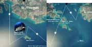
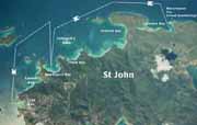
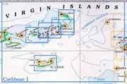
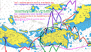
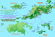
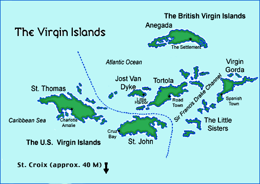 This page will get you on your way to visualizing your
days and nights in this tropical paradise. Although you will still
need the appropriate navigation charts (we recommend Caribbean
Yachting Charts "St. Thomas to Sombrero" available through
Bluewater and other distributors, see links below), These chartlets
and composed aerial photos will help you plan your itinerary and
get the adventurous juices flowing. Click on any link for a pop-up
window with the chart, map or image:
This page will get you on your way to visualizing your
days and nights in this tropical paradise. Although you will still
need the appropriate navigation charts (we recommend Caribbean
Yachting Charts "St. Thomas to Sombrero" available through
Bluewater and other distributors, see links below), These chartlets
and composed aerial photos will help you plan your itinerary and
get the adventurous juices flowing. Click on any link for a pop-up
window with the chart, map or image:
Read about our April trip with the kids and see a bunch of photos
here: Kids On Boats!
Home The
Boat Book Your Charter About Us The
Islands Travel Tips
|